
Surveying is vital in land development, construction, and engineering, and accurate measurements are at its core. Chains have long been essential tools in surveying and have played a pivotal role in ensuring precision. Despite technological advancements, chains remain indispensable for property mapping, land division, and project planning due to their simplicity and effectiveness.
Chains are surveying tools specifically designed to measure distances accurately and efficiently. Over the centuries, their design has evolved to meet varying survey requirements. Today, chains are classified based on length, material, and purpose, catering to different types of surveys and levels of accuracy.
This blog explores the types of chains in surveying, their lengths, uses, and importance. It provides insights into popular options like the metric chain in surveying, the revenue chain, and the engineering chain and addresses the challenges of using chains in measurement. Whether you’re a novice or an expert, understanding these tools will help you enhance your survey accuracy and streamline your projects.
How Many Types Of Chains Are Used In Chain Surveying?
Chain surveying measure distances using either a chain or a tape. It is a type of land surveying that focuses solely on linear measurements and does not involve angular measurements.
This discussion will cover the definition of chain surveying, the principles underlying this technique, the various types of chains in surveying, the instruments employed in chain surveying, the procedure followed in conducting a chain survey, and a diagram illustrating chain surveying. Chain surveying is well-suited for rugged terrains and challenging conditions.
10 Different Types of Chains Used in Surveying
1. Metric Chain in Surveying

The metric chain is the most widely used in modern surveying due to its versatility and ease of use. Its design ensures accurate measurements, making it indispensable in various fields.
- Lengths: Metric chains come in standard sizes of 5m, 10m, 20m, and 30m, catering to diverse surveying needs.
- Purpose: Ideal for land measurement, particularly for small to medium-sized plots where precision is critical.
- Applications: Commonly used in engineering surveys, topographical surveys, and general land measurement tasks.
Why Choose a Metric Chain?
Metric chains are lightweight and easy to handle, ensuring efficient measurements without causing fatigue. Their durability and resistance to wear make them ideal for long-term use in engineering and construction projects. Their precise results and user-friendly design have made them a preferred choice for modern surveyors.
2. Revenue Chain In Surveying

The revenue chain is specifically designed for agricultural and cadastral surveys, which are crucial in land administration.
- Lengths: This chain is standardized at 33 feet, aligning with the requirements for measuring agricultural fields.
- Purpose: Primarily used for calculating land areas for tax assessments and maintaining accurate land records.
- Applications: Frequently employed by revenue departments and in land administration tasks.
Importance of Revenue Chains
Revenue chains are essential for ensuring transparency and fairness in assessing agricultural taxes. They also help maintain accurate land ownership and property boundary records, which are vital for governance and dispute resolution.
3. Engineer’s Chain In Surveying

The engineering chain is crafted to meet the rigorous demands of large-scale construction and civil engineering projects.
- Lengths: Typically available in 100 feet, the chain is designed for measuring extensive land areas.
- Purpose: Used for precise surveys in projects such as roads, bridges, dams, and other infrastructural developments.
- Applications: Employed in civil engineering surveys that demand high accuracy.
Why Use an Engineering Chain?
The engineering chain is built for precision and durability, making it ideal for use in challenging terrains. Its robust construction ensures consistent accuracy across vast areas, helping surveyors achieve reliable measurements for large-scale projects.
4. Band Chain or Steel Band in Surveying
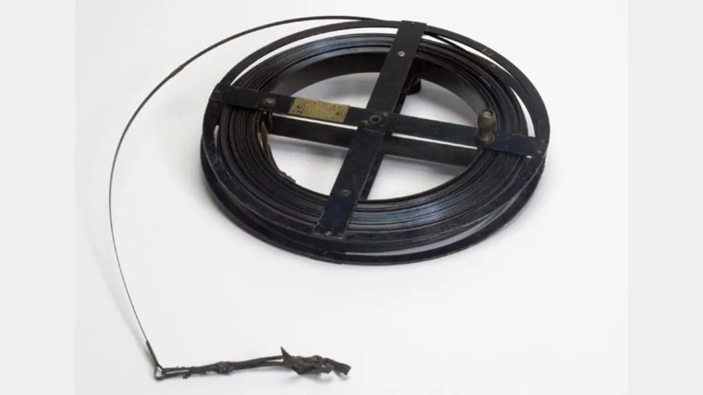
The steel band chain is a modern alternative designed for high-precision measurements.
- Lengths: Available in 20m and 30m sizes, it caters to various surveying tasks.
- Purpose: Best suited for projects requiring exceptional accuracy, such as building layouts.
- Applications: Widely used in engineering surveys and construction projects.
Advantages of Steel Band Chains
Steel band chains are durable and reliable, resistant to rust and wear. Their lightweight nature ensures ease of handling, while their precision makes them indispensable for tasks where accuracy is paramount.
5. Gunter’s Chain or Surveyor’s Chain
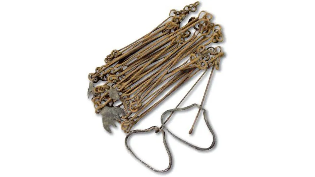
Also known as the surveyor’s chain, the Gunter’s chain has significant historical importance in surveying practices.
- Lengths: Fixed at 66 feet, the chain is divided into 100 links, simplifying the process of area calculations.
- Purpose: Traditionally used for land measurements, particularly in dividing properties into acres.
- Applications: Found in rural surveys and historical land divisions.
Unique Features of Gunter’s Chain
The Gunter’s chain is tailored for calculations involving acres, making it a valuable tool for specific surveys. Though less common today, its simplicity and accuracy make it worthwhile for tasks requiring traditional measurements.
6. Tape Chain
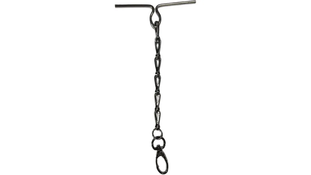
The tape chain is a versatile, portable tool for quick and efficient measurements.
- Lengths: Commonly available in 15m, 20m, and 30m, suitable for short-distance measurements.
- Purpose: Used in urban surveys, construction planning, and general site measurements.
- Applications: Perfect for road planning, small-scale construction projects, and temporary measurements.
Why Choose a Tape Chain?
The tape chain’s flexibility and portability make it a preferred choice for professionals who require mobility. It ensures accurate results in environments where quick adjustments and efficient handling are essential.
7. Linen Tape in Surveying

The linen chain is a lightweight and cost-effective option made from woven linen.
- Lengths: Typically available in 10m and 15m sizes.
- Purpose: Used for preliminary surveys and short-term measurement tasks.
- Applications: Commonly employed for temporary land measurements and minor projects.
Limitations of Linen Chains
While affordable and lightweight, linen chains lack durability and are prone to wear and tear. Thus, they are suitable for minor or short-duration surveys but unsuitable for extensive or precise tasks.
8. Surveyor’s Chain

The surveyor’s chain is a versatile tool, adaptable to various surveying needs.
- Lengths: Available in 30m and 50m, making it suitable for diverse tasks.
- Purpose: Used in engineering, cadastral, and topographical surveys.
- Applications: Ideal for general surveying tasks requiring a reliable and adaptable tool.
Benefits of Surveyor’s Chains
Surveyor chains are durable, reliable, and easy to use, making them popular among professionals. Their adaptability ensures they can efficiently handle a wide range of measurement tasks.
9. Plastic Chain

The plastic chain is a lightweight, weather-resistant option ideal for specific environments.
- Lengths: Commonly available in 10m and 20m, catering to short-distance measurements.
- Purpose: Used in coastal surveys, wetlands, and other corrosion-prone areas.
- Applications: Preferred in environments where durability against moisture and environmental damage is critical.
Why Use Plastic Chains?
Plastic chains are ideal for harsh conditions. They offer excellent resistance to environmental factors while remaining lightweight and easy to handle.
10. Invar Chain in Surveying
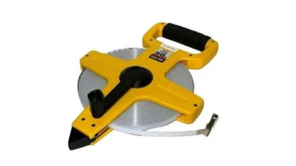
The invar chain is designed for high-precision measurements and is made from nickel and steel alloy.
- Lengths: Available in 20m and 30m, perfect for tasks requiring exceptional accuracy.
- Purpose: Used in engineering surveys and projects sensitive to thermal expansion.
- Applications: Commonly employed in scientific surveys and projects requiring utmost precision.
Unique Features of Invar Chains
The invar chain maintains consistent length, even under extreme temperature variations, ensuring unparalleled accuracy. This makes it indispensable for projects where precise measurements are non-negotiable.
Why Is Chain Measurement Important?
1. Accuracy
Chain measurement is crucial for maintaining accuracy in surveying. Chains offer consistent and precise results, making them indispensable for tasks such as property mapping, land division, and construction projects. The standardized lengths and clear markings of chains ensure that measurements remain uniform, reducing the chances of errors in critical calculations like area determination or boundary alignment.
2. Efficiency
Chains simplify measuring long distances, making surveying tasks quicker and more efficient. Unlike digital devices that require batteries or calibration, chains can be used immediately, making them a reliable choice for fieldwork. Their design allows surveyors to cover large tracts of land in minimal time, which is especially valuable in time-sensitive projects like infrastructure development.
3. Versatility
Chains, which come in many types, including metric, revenue, and engineering chains, are versatile tools that cater to various surveying needs. For instance, Gunter’s chains are ideal for traditional land division, while invar chains are preferred for high-precision measurements in scientific projects. This adaptability ensures surveyors can select a chain that perfectly matches their project’s requirements.
4. Durability
High-quality materials like steel, invar, and plastic ensure chains remain durable even in challenging environments. Chains such as plastic chains are resistant to corrosion and moisture, making them ideal for coastal surveys, while steel band chains are robust enough to withstand rough terrains. This durability ensures reliable performance and reduces the need for frequent replacements, making them cost-effective tools for long-term use.
Challenges of Using Chains in Surveying
If the Chain is Too Short
- Overestimated Measurements: Short chains result in inflated distance calculations, leading to errors in project planning and execution.
- Area Miscalculations: Overestimated measurements can cause inaccuracies in land area calculations, potentially increasing costs due to incorrect valuations.
- Boundary Errors: Short chains can cause misplaced boundaries, leading to disputes over property lines and legal complications.
If the Chain is Too Long
- Underestimated Measurements: Long chains produce underestimated distances, which can significantly alter project layouts and designs.
- Survey Inconsistencies: Inaccurate measurements disrupt the reliability of the survey, making the final data unusable.
- Design Errors: Incorrect dimensions can lead to misaligned structures, requiring costly modifications during or after construction.
Conclusion
Understanding the types of chains in surveying is essential for accurate and efficient measurements. Each tool’s purpose is specific, from the versatile metric chain in surveying to the specialized invar chain. Using the proper chain ensures precision, saves time, and reduces costs, making them indispensable in surveying.
The appropriate chain is crucial for large-scale engineering projects and small cadastral surveys. Proper calibration and maintenance ensure the best results and avoid common measurement challenges.
Chains remain a cornerstone of surveying. They balance traditional reliability with modern requirements and ensure successful outcomes in land and construction projects.
Different Types Of Chain In Surveying FAQ’s:
1. How many types of chains are used in chain surveying?
1. Gunter's chain
2. Metric chain
3. Engineer's chain
4. Steel band or band chain
5. Revenue chain
2. What are the three main types of surveying?
Cadastral Surveying:Establishes and defines land boundaries for legal and administrative purposes.
Engineering Surveying: Focuses on gathering data for construction and engineering projects.
Astronomical Surveying: Determines the positions of celestial objects for geographic orientation.


